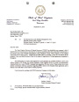


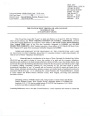
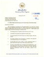
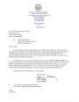
Mineral Development Properties
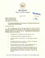
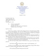
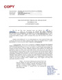
The State of West Virginia, through the Division of Natural Resources, holds title to certain lands and mineral resources in the state. The Division of Natural Resources administers and manages those lands to provide for the conservation, development, protection, enjoyment and use of the state's natural resources by its citizens and visitors.
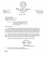
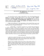
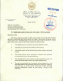
West Virginia law permits the Division of Natural Resources to lease coal, oil, gas, sand, gravel and any other minerals under its control and management for responsible development and production. However, the Division must employ a competitive bidding process before entering into an arrangement to lease minerals subject to its control.
|
Nominate a Property Bid On Property Bid Questionnaire Lessee Bid Submission Form |
| County | Property Description | Governor’s Approval Letter | Bid Prospectus | Date Bid Opens | Date Bid Closed | Bidder Award Letter | Executed Lease Agreement |
| Tyler | A competitive bid on Oil and Gas of 18 net acres, more or less, underlying that part of the Buffalo Run Wildlife Management Area (W.M.A.) Being the northern portion of that tract containing 60 acres, more or less, designated Tax Map 9 Parcel 18 Union District, Tyler County, West Virginia. |  |
-2026.jpg) |
8/6/2026 10:00 AM | 8/5/2026 4:00 PM | ||
| Tyler | A competitive bid on Oil and Gas on 42 aggregate acres, more or less and being 21 net acres, more or less underlying that part of the Buffalo Run Wildlife Management Area (W.M.A.) Being the southern portion of that tract containing 60 acres, more or less designated Tax Map 9 Parcel 18 Union District, Tyler County, West Virginia |  |
-2026.jpg) |
8/6/2026 10:30 AM | 8/5/2026 4:00 PM | ||
| Harrison | A competitive bid on 18 net acres, more or less, of oil and gas underlying a portion of The West Fork River, Clay-Shinnston District, Harrison County, West Virginia, commencing at a point from the ordinary low water mark on each side of the said River at Latitude 39° 23’ 47.9”, Longitude -80° 18’ 14.5”, thence upstream and ending at Latitude 39° 24’ 05.3”, Longitude -80° 17’ 24.3”. |
 |
.jpg) |
3/26/2026 | 3/25/2026 |
 |
.jpg) |
| Tyler | A competitive bid on Oil and Gas, 75.02 acres, more or less, Underlying that part of the Buffalo Run Wildlife Management Area (W.M.A.), Designated Tax Map 9, Parcel 5, Union District, Tyler County, West Virginia |
 |
_Feb_2026.jpg) |
3/26/2026 | 3/25/2026 |
 |
.jpg) |
| Brooke | A competitive bid on Oil and Gas 131.7 acres, more or less Underlying a portion of The Ohio River From the ordinary low water mark on each side of the said river, Commencing at a point within mile marker 78 at Latitude: 40.221462° Longitude: -80.661843°, Concluding at a point within mile marker 79 at Latitude: 40.210514° Longitude: -80.664339°, Buffalo District, Brooke County, West Virginia |
 |
_Feb_2026.jpg) |
3/26/2026 | 3/25/2026 |
 |
 |
| Ohio |
Oil and Gas 78.439 acres, more or less underlying a portion of the Ohio River (Mile Marker 86) (Commencing at Latitude 40.138710°, Longitude -80.706564° ending at Latitude 40.132519°, Longitude -80.706963°) Richland District, Ohio County, West Virginia |
 |
 |
11/11/25 @ 11am | 11/10/25 @ 4pm |
 |
-OG-26-I-35-19037.jpg) |
| Ohio |
A prospectus on 17.998 net acres, more or less, underlying that part of Fish Creek being the area underlying said creek from the normal low water marks on each side of the creek consisting of: starting at Latitude 39° 41’ 20” Longitude -80° 28’ 46”, and ending at Latitude 39° 41’ 38”, Longitude -80.706963°, Clay and Church Districts, Wetzel County, West Virginia |
 |
 |
11/11/25 @ 10am | 11/10/25 @ 4pm |
 |
_OG-26-I-52-19036.jpg) |
| Wetzel |
Oil and Gas 193.37 net acres, more or less underlying a portion of the Ohio River (Mile Marker 129.9-131) (Commencing at Latitude 39.617270, Longitude -80.913561 ending at Latitude 39.619599, Longitude -80.881445 Magnolia District, Wetzel County, West Virginia |
-Sept-2025.jpg) |
-Sept-2025.jpg) |
10/9/25 @ 10am | 10/8/25 @ 4pm |
 |
 |
| Pleasants, Tyler |
Oil and Gas 103.76 acres, more or less underlying a portion of the Ohio River (Mile Marker 147.25-148) (commencing at Latitude 39.464099, Longitude -81.115360 ending at Latitude 39.454527, Longitude -81.121738 and 3.88 acres, more or less, underlying portions of Engle Run and Bens Run Union District, Pleasants County Union District, Tyler County, West Virginia |
 |
_June_2025.jpg) |
7/3/2025 @11am | 7/2/2025 @4pm |
 |
.jpg) |
| Wetzel |
Oil and Gas 38.1877 acres, more or less, of oil and gas underlying a portion of Fish Creek, Clay District, Wetzel County West Virginia and 7.911 acres, more or less, of oil and gas underlying portions of North Fork and Willey Fork of Fishing Creek, Grant District, Wetzel County West Virginia.
|
  |
_June_2025.jpg) |
7/3/2025 @11am | 7/2/2025 @4pm |
 |
  |
| Wetzel |
Oil and Gas 48.76 acres, more or less Underlying a portion of the Ohio River (Mile Marker 132) (commencing at Latitude 39.616371, Longitude -80.918938 and ending at Latitude 39.617464, Longitude -80.913456) Magnolia District, Wetzel County West Virginia |
-Mar-2025.jpg) |
-Mar-2025.jpg) |
3/27/25 @10am | 3/26/25 @4pm |
 |
.jpg) |
| Tyler |
105.38 acres, more or less (2 tracts) |
 |
-Aug-2024.jpg) |
9/18/2024 @10am | 9/17/2024 @4pm |
 |
 |
| Marion |
25 acres, more or less, underlying a portion of Buffalo Creek (commencing at the confluence of Huey Run, Latitude 39.518, Longitude -80.408 downstream to Latitude 39.530, Longitude -80.353)
Mannington District, Marion County |
-Aug-2024.jpg) |
-Aug-2024.jpg) |
9/5/2024 @10am | 9/4/2024 @4pm |
-Sept-2024.jpg) |
-Feb-2025.jpg) -Feb-2025.jpg) |
| Harrison |
8.93 acres, more or less, underlying portions of West Fork River, Clark-Outside District, Harrison County, West Virginia. |
 |
_July_2024.jpg) |
8/21/2024 @10am | 8/20/2024 @4pm |
 |
 |
| Marshall |
22.05 acres, more or less (parts of 2 tracts), Part of Burches Run Wildlife Management Area, Webster District Marshall County, West Virginia |
 |
.jpg) |
2/29/2024 @10am | 2/28/2024 @4pm |
 |
 |
| Tyler & Pleasants |
31.50 acres, more or less, of oil and gas Underlying a portion of Middle Island Creek Union District, Tyler County and Union District, Pleasants County, West Virginia |
 |
 |
2/1/2024 @2pm | 1/31/2024 @4pm |
 |
 |
| Ohio & Marshall | 193.33 acres, more or less Underlying a portion of the Ohio River between Mile Marker 91 and Mile Marker 93 Ritchie District, Ohio County, and Union District, Marshall County, West Virginia |
.jpg) |
-(Oh-Co)-May-2023.jpg) |
5/26/2023 @10am | 5/25/2023 @4pm |
 |
 |
| Marshall | 25.178 acres, more or less, Part of Big Wheeling Creek, Sand Hill and Webster Districts, Marshall County, West Virginia |
-Feb-2023.jpg) |
-Feb-2023.jpg) |
2/28/2023 @10am | 2/27/2023 @4pm |
 |
 |
| Brooke | 177.241 acres (6 tracts), more or less, Part of Castlemans Run Lake Wildlife Management Area, Buffalo District, Brooke County, West Virginia, Liberty District, Ohio County, West Virginia |
-Jan-2023.jpg) |
-Jan-20232.jpg) |
2/7/2023 @10am | 2/6/2023 @4pm |
 |
 |
| Wetzel | 99.15 acres, more or less, of oil and gas underlying a portion of Fishing Creek Magnolia and Green Districts |
_Oct_2022.jpg) |
_Oct_2022.jpg) |
11/2/2022 |
 |
 |
|
| Wetzel | 79.46 acres, more or less, of oil and gas underlying portions of Fishing CreekGreen and Grant Districts |
_Oct_2022.jpg) |
_Oct_2022.jpg) |
11/2/2022 | |||
| Marshall | 546.10 acres, more or less, of oil and gas underlying a portion of the Ohio River between Mile Marker 102 and Mile Marker 107 |
 |
 |
10/6/22 | 10/5/22 | ||
| Ohio | 69.76 acres, more or less. Underlying a portion of the Ohio River between Mile Marker 81 and Mile Marker 82 in in Richland District, Ohio County, West Virginia |
 |
 |
6/10/22 | 6/9/22 | ||
| Tyler | 30.03 acres, more or less, of oil and gas underlying a portion of Middle Island Creek. Union Disctrict. |
 |
 |
2/25/22 | 2/24/22 | ||
| Gilmer | 6.30 acres, more or less, of oil and gas (being 3.43 acres underlying a portion of the Little Kanawha River and 1.42 and 1.45 acres underlying a portion of Route 5). Dekalb District. |
 |
 |
2/25/22 | 2/24/22 | ||
| Wetzel | 96 acres- Wetzel County, WV- Center District- Oil and Gas Bid. |
 |
 |
12/3/2021 | 12/2/2021 | ||
| Tyler |
PROPERTY DESCRIPTION-57.23 ACRES MIDDLE ISLAND CREEK UNION DISTRICT |
 |
6/4/2021 | 6/3/2021 |
_June_2021.jpg) |
||
| Tyler | 2.97 ACRES UNDERLYING MIDDLE ISLAND CREEK, CENTERVILLE DISTRICT, TYLER COUNTY WV. |
 |
4/28/2021 | 4/20/2021 |
 |
||
| Tyler | 13.85 acres underlying a portion of Middle Island Creek in the Ellsworth District of Tyler County. |
 |
 |
3/11/2021 | 3/10/2021 |
 |
|
| Tyler | 7.94 AC UNDERLYING MIDDLE ISLAND CREEK IN ELLSWORTH DISTRICT, TYLER COUNTY |
 |
 |
2/25/2021 | 2/24/2021 |
 |
|
| Tyler | 16.97 AC UNDERLYING MIDDLE ISLAND CREEK IN UNION DISTRICT, TYLER COUNTY |
 |
 |
2/25/2021 | 2/24/2021 |
 |
|
| Marshall & Wetzel | 950.3948 acres underlying MM 112 - 123 on the Ohio River |
 |
 |
12/10/2020 | 12/9/2020 | ||
| Wetzel | Big Fishing Creek - 13.28 acres, Green District, Wetzel County |
 |
|
10/29/2020 | 10/28/2020 |
 |
|
| Tyler | Middle Island Creek - 19.46 acres Ellsworth District, Tyler County |
 |
 |
10/29/2020 | 10/28/2020 |
 |
|
| Tyler | Middle Island Creek - 5.55 acres Union District, Tyler County |
 |
 |
10/29/2020 | 10/28/2020 |
 |
|
| Marshall | 19.842 acres (Utica/Point Pleasant formation only) underlying portions of Wheeling Creek. |
 |
 |
4/30/20 | 4/29/20 |
 |
 |
| Lewis | 30.255 acres underlying a portion of Middle West Fork Creek (West Fork River) |
 |
 |
4/30/20 | 4/29/20 |
 |
 |
| Hancock, Brooke, Ohio, Marshall & Wetzel | Sand & Gravel underlying the Ohio River at MM 54 - MM126.4 |
 |
 |
3/13/20 | 3/12/20 |
 |
|
| Harrison and Lewis | 145.312 acres underlying a portion of the Middle West Fork Creek (West Fork River) |
 |
 |
1/29/20 | 1/28/20 |
 |
 |
| Marshall | 54.56 acres (Utica formation only) being part of Burches Run WMA |
 |
 |
1/24/20 | 1/23/20 |
 |
 |
| Brooke | Underlying portion of the Ohio River within MM68 to southern end of MM 70 being approximately 320.44 acres |
 |
 |
1/24/20 | 1/23/20 |
 |
 |
| Hancock, Brooke, Ohio, Marshall & Wetzel | Sand & Gravel underlying the Ohio River at MM 54 - MM126.4 |
 |
 |
11/22/19 | 11/21/19 | NO BID ACCEPTED | |
| Ohio | 163.18 acres being part of Bear Rock Lake WMA and being Tax Map T5, Parcel 1. |
 |
 |
11/8/19 @ 2pm | 11/7/19 @ 4pm |
 |
 |
| Ohio | 36.297 acres being part of Bear Rock Lake WMA and being Tax Map L14, Parcel 29 |
 |
 |
11/8/19 @ 2pm | 11/7/19 @ 4pm |
|
 |
| Ohio | 43.004 acres being part of Bear Rock Lake WMA and being Tax Map T5, Parcel 2. |
 |
 |
11/8/19 @ 2pm | 11/7/19 @ 4pm |
|
 |
| Marshall | Underlying portion of the Ohio River from MM108 to MM109.12 containing 147.313 acres m/l. |
 |
 |
10/25/19 | 10/24/19 |
 |
 |
| Marshall | 8.5 acres (Utica) and 4.1 acres (Marcellus) underlying portions of Fish Creek in the Franklin District. |
 |
 |
10/9/19 @ 2pm | 10/8/19 @ 4pm |
 |
 |
| Marshall | Underlying portion of the Ohio River containing 127 acres, m/l, and being in the Franklin District. |
 |
 |
8/27/19 @ 2PM | 8/26/19 @ 4PM | NO LEASE OBTAINED | |
| Brooke and Ohio | Navigable portions of the Ohio River and Cross, Buffalo and Short Creeks from MM74 to MM77 |
 |
 |
8/27/19 @ 2PM | 8/26/19 @ 4PM |
 |
 |
| Marshall | Underlying portions of Wheeling Creek containing 93.91 acres, m/l, and being in Sand Hill, Union and Webster Districts. |
 |
 |
8/27/19 @ 2PM | 8/26/19 @ 4PM |
 |
 |
| Tyler | Underlying portions of Josephs Mill Public Access Site, containing 1.23 acres, m/1 |
 |
 |
4/12/2019 3:00 p.m. |
4/12/2019 3:00 p.m. |
 |
 |
| Tyler | 20.41 net mineral acres of oil and gas underlying portions of Middle Island Creek |
 |
 |
4/12/2019 3:00 p.m. |
4/12/2019 3:00 p.m. |
 |
 |
| Pleasants | Underlying portions of Middle Island Creek, containing 20.99 acres, m/l |
 |
 |
4/12/2019 1:00 p.m. |
4/12/2019 3:00 p.m. |
 |
 |
| Pleasants | Underlying portions of Middle Island Creek, containing 26.60 acres, m/l |
 |
 |
4/12/2019 3:00 p.m. |
4/12/2019 3:00 p.m. |
 |
 |
| Tyler | 28.54 net mineral acres of oil and gas underlying portions of Middle Island Creek |
 |
 |
4/12/2019 3:00 p.m. |
4/12/2019 3:00 p.m. |
 |
 |
| Pleasants | 32.12 net mineral acres of oil and gas underlying portions of Middle Island Creek |
 |
 |
4/12/2019 1:00 p.m. |
4/12/2019 3:00 p.m. |
 |
 |
| Pleasants | Underlying portions of Middle Island Creek, containing 13.63 net acres, m/l |
 |
 |
3/28/2019 3:00 p.m. |
3/28/2019 3:00 p.m. |
 |
 |
| Pleasants | Underlying portions of Middle Island Creek, containing 17.072 net acres, m/l |
 |
 |
3/28/2019 3:00 p.m. |
3/28/2019 3:00 p.m. |
 |
 |
| Pleasants | Sugar Creek and Middle Island Creek 1.37, acres, m/l |
 |
 |
2/14/2019 3:00 p.m. |
2/14/2019 3:00 p.m. |
 |
 |
| Wetzel | Ohio River mile markers 128 to 130 (451 acres, m/l) |
 |
 |
1/10/2019 3:00 p.m. |
1/10/2019 3:00 p.m. |
 |
 |